October 2023 McCloud River Fishing Report and FreeeFishing Map Access info, Where on River to fish, Best Flies and Hunting Club and Private Hunting Ranch information
 |
| McCloud River Fishing Map |
River Analysis
Here’s the facts:
In the late 1800s, McCloud River rainbows provided the genesis for
trout in Alaska, New Zealand and
Argentina. The lower river has trout restrictions and permits are needed to fish the Nature Conservancy section.
Location: The famous McCloud River is located 12 miles from the town of McCloud on Highway 89. To reach the more technical (artificial only) wild trout lower river, go around Lake McCloud and take Squaw Valley Creek road to Ah-Di-Nah. See our Fishing Map above.
For the bait fishing, etc. Upper River, there is a turnoff to Fowler's Camp on the from Highway
89, and the river is reachable by foot upstream from Fowler's Camp.
Species: Rainbow trout and German brown trout.
There are a few Dolly Varden in the McCloud River, which must be let go!!
The limit
on the lower river from the dam to Ladybug Creek is two fish with barbless flies and lures only; the limit from Ladybug Creek downstream through the nature conservancy is “no fish”, and
fishing is barbless flies and lures
only.
General trout restrictions
apply on the upper river, with a
10-fish- limit during the trout season.
Bait, hardware and flies are all
allowed.
Camping: The only camping
on the upper river is at Fowler's Camp. The Forest Service has a campground on the lower river at Ah-Di-Na.
Ah-Di-Na "Private but accessible" Usually it's no problem
signing in to fish this prime stretch of
stream. There is also a
trail that goes along the west side of
the river from Ah-Di-Na to the Preserve
cabin, a lengthy trek. Ah-Di-Na campground hardly ever fills up,
As our fishing map shows, Lower McCloud commences immediately below the dam, some 7 miles of access, are public waters. Ash Camp is on the east side of the river, while Ah-Di-Na campground and the Nature Conservancy are on the west side.
Upper McCloud goes from McCloud town proper, and go south from downtown McCloud on Squaw Valley Road, drive 8 miles down to McCloud Reservoir bear right until you see a post for for Ah-Di-Na and the Nature Conservancy area.
Here you have 2 choices to the river: left to Ash Camp or right to Ah-Di-Na and the Preserve.
Ah-Di-Na: Once you go right to Ah-Di-Na, be prep;ared for a eight mile fairly rough drive. The Preserve starts downstream from here
Ash Camp: You drive across the dam, for about a mile to Ash Camp. Across fromcamp, a trail gives tough access to the river three miles, but take heed, its canyon country but at least not many fishermen.
Nature Conservancy (aka the McCloud Preserve): Once your arrive in Ah-Di-Na, you can fish there, as the Preserve area is another 2 miles of more road. Obtaining access during the week may not be a problem, but you should make reservations for weekends.
When and How to Fish the McCloud River
Presentation with light leaders are required to fool these
fish, and there are still some trophy-class fish available in the lower river. May and June are optimum months, but July and August snow runoff often discolors the
McCloud, creating difficult fishing conditions. In the fall on the McCloud, both the upper and lower reaches can be terrific.
Upper river anglers from
Fowler’s Camp down to Lake McCloud can
limit at 10 fish a day and anglers
do quite well with flies, spinners, salmon
eggs and worms.
Stream fishing is a
challenge if you don‘t know how to find
where the fish are. First, fish will always
be where food is available with the
least amount of effort. On a river, trout will be concentrated in those areas
where they get the consistent supply of
food without having to contest with a lot of
current.
Yellow Cahill and
Mosquito in sizes 12 or 14 are the
standard here for taking fish. But, while Northern
California’s Lower Hat Creek and Fall River are using tiny 18
and 20 flies, the McCloud River in July you should toss big flies.
The best time of day for fishing dries is from 6:00 p.m. until dark, because that's when hatches are most prolific and trout feed most heavily. But fish are also taken in the early mornings on a variety of wet patterns.
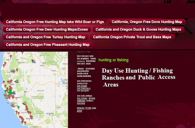
Here is a screenshot of the site, it also has public fishing areas and fishing maps,
California and Oregon hunting and fishing maps of hunting clubs, hunting ranches, public and private fishing
If you want other places to go, or need some fishing maps, including some private access to Fall River and Hat Creek, please go to www.freehuntfishmaps.comHere is a screenshot of the site, it also has public fishing areas and fishing maps,
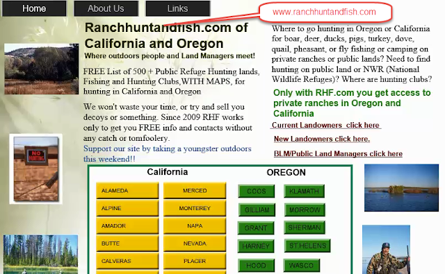
Also, if your interested in private hunting ranches or hunting clubs, we recommend a sister site to freehuntfishmaps, which shows county by county Hunting Clubs and private hunting ranches in California and Oregon:
 |
| www.ranchhuntandfish.com |

